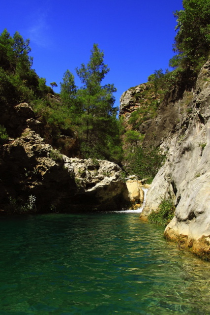
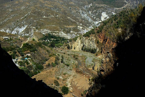
The region around Órgiva is a walker’s paradise and Rural Paradise is an excellent base from which to enjoy many and varied walks. There are some walks directly from Rural Paradise and others that you need to drive to. You can walk along the flat promenades of the coastal villages, the gentle rises around Rural Paradise, the dry and wet river beds, follow the acequias (man-made water channels) and the many trails in the surrounding mountains.
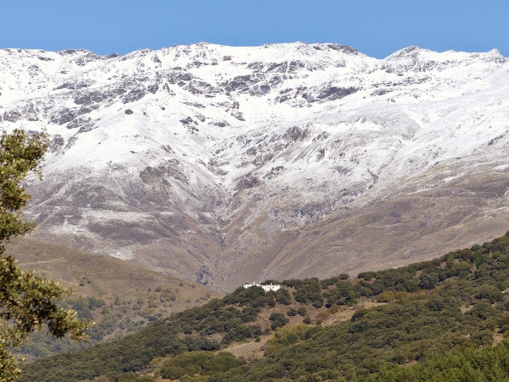
Whether you are interested in high altitude treks in the peaks of the Sierra Nevada, many of which are over 3,000 metres or casual meandering around the fascinating villages of the high Alpujarra, this area is a fabulous area for walking. The GR7 path (Gran Recorrido) which begins in Tarifa in Cadiz province and crosses Europe all the way to Athens in Greece passes through the Alpujarras and there is an extensive network of other tracks to choose from. The paths are well sign-posted and are often old mule tracks - so the steepness is no more than a loaded mule can manage! The area is never crowded with walkers and you can often be out in the mountains all day and encounter no more than a shepherd with his flock.
If you choose your walks carefully and are prepared to make the most of the day then walking is possible here at all times of year. For example, in August, when the lower valleys are possibly too hot for vigorous activities, temperatures in the accessible high mountains may not go much above 20 degrees centigrade. The best months to walk in Las Alpujarras are April to mid-June, and September to mid-November.
Tips for walking and hiking:
- Take a good quality walking map or compass with you. Do not rely on cell signal or batteries.
- Wear good quality, sturdy, waterproof walking boots. Trekking poles are great in rough sections.
- Let someone know where you are going.
- Take a mobile phone or GPS if possible. For longer trips take extra batteries.
- Take plenty of water as southern Spain can be really hot.
- Protect yourself from the sun, it is better to avoid walking in the heat of the afternoon.
- Wear suitable clothes, layers are good as although it may be hot at lower altitudes, it can be cold higher up.
- Keep to a clear path and avoid taking shortcuts unless you are absolutely confident of the area.
- Be aware that the weather can change very quickly and fog, rain, or storms, especially lightning, can occur quickly and without warning.
- Be aware that dry riverbeds and streams can quickly flood during bad weather.
- Help to protect and maintain the area you are walking through.
There are self-guided walks some of which have downloadable PDFs with detailed maps, altitude profiles and step-by-step descriptions for you to take with you, as well as tracks that you can load onto a GPS device or mobile, so that you’ll have all the information you need when you’re out walking. Alternatively, you can hire a guide.
Typical prices to hire a guide
If you would like to hire a guide for your outing, typical daily rates for leading you in the hills or mountains start from about €30 per person, depending on the number of people and activities. Examples are:
1 day hill walking in ‘low level’ areas:
- 1-2 People €80 per person
- 3 People €70 per person
- 4 People €60 per person
- 5 People €50 per person
- 6-8 People €45 per person

1 day walking in the mountains and summits:
- 1-2 People €100 per person
- 3 People €80 per person
- 4 People €65 per person
- 5 People €60 per person
- 6 People €50 per person
- 7-8 People €45 per person
Climbing Mulhacén or Alcazaba using the Sierra Nevada National Park bus from Capileira as a day excursion:
- 1-2 People €112 per person
- 3 People €92 per person
- 4 People €77 per person
- 5 People €72 per person
- 6 People €62 per person
- 7-8 People €57 per person
- Prices do not include the bus fare of approximately €12 per person.
Climbing Mulhacén over 2 days overnighting at the Poqueira Refuge (including meals except for your packed lunch on day 1):
- 1 Person €320 per person
- 2 People €260 per person
- 3 People €220 per person
- 4 People €190 per person
- 5 People €170per person
- 6 People €160 per person
- 7 People €150 per person
- 8 People €140 per person
1 day rock scrambling (max 4 people per guide)
- 1-2 People €120 per person
- 3 People €100 per person
- 4 People €80 per person
Useful websites
To help you further in planning your holiday at Rural Paradise here are a few websites you may wish to look at.
- Alpujarras
- The Life of Riley
- Sierra Nevada Guides
- Trek Sierra Nevada
- Walking in Andalucía
- Alpujarra Walking Holidays
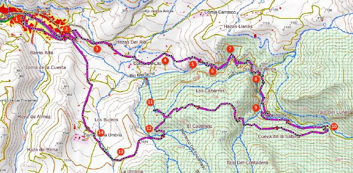
Some walks for you
These are just some of the many walks available to you. We have divided them into 3 sections.
- Directly from Rural Paradise
- Within 1 hours drive
- Within 1.5 hours drive


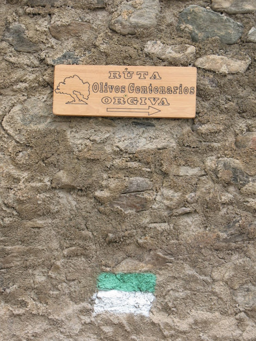
Los Mineros – Miner’s route – Orgiva
 This walk is about 8.2km and will take roughly 3 and a half hours.
The suggested route is more than just a path, it is a journey through the mining history of the Sierra de Lújar. Mining has been the backbone of the economy in Las Alpujarras since immemorial time, and was especially important in Órgiva from 1800 to 1989.
La Atalaya – Pampaneira

Pitres Ferreirola – Pitres

This walk is about 3km and will take roughly 1 hour.
Acequia Alta – Mecina Bombaron

Acequia Baja – Mecina Bombaron

Pedro A. de Alarcon – Torvizcon
This walk is about 8.3km and will take roughly 4 and a half hours.
The route offers you the chance to relive some of the adventures, stories and caprices that the great writer from Granada, Pedro Antonio de Alarcon, experienced in 1872 during his journey through the Alpujarras in the company of his mules, from which he was inseparable.
Panjuila – Almegijar
La Cuesta – Almegijar
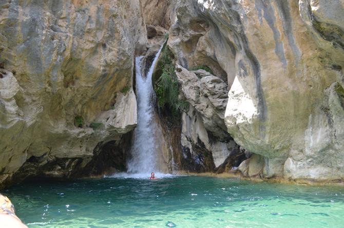
The Walk of the Ruined Mills & Arab Baths
This walk is about 8.5km and will take roughly 3 and a half hours to 4 hours.
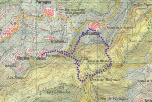
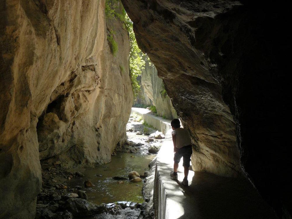
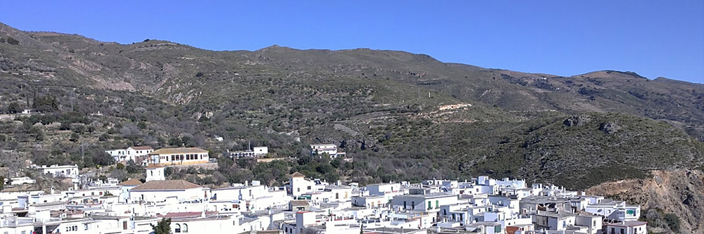
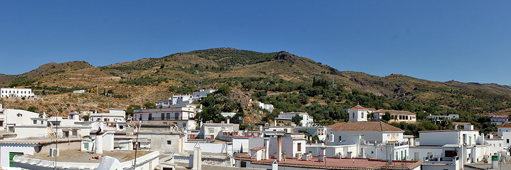
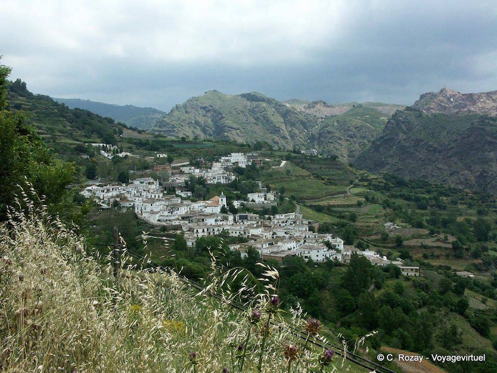
The walk begins and ends in the tiny village of Ferreirola. For most of the way it follows old muleteer tracks that twice cross the steep-sided barranco of the Río Trevélez. Although there are two steep uphill sections this is an easy half-day walk which you can easily stretch out by picnicking along the way or by stopping for a drink or meal in Busquístar. This itinerary has a kilometre or so of tarmac but there's virtually no traffic and the views across the gorge are fabulous.
The walk begins in the main square of Ferreirola, La Plaza de Santa Cruz, in front of the church. Pass in front of the four fountains and the village wash house then continue past Villa Kiko along Calle Rosario. At the end of the street bear right past the doctor’s surgery, el Consultorio, then take the first left and pass beneath a tinao (an architectural solution, typical of Las Alpujarras like a tunnel). You soon pass a signpost for Mirador (viewing point) and a map of the long distance footpath, the GR142.
The path soon passes by a spring with ceramic tiles, La Fuente Gaseosa, then crosses a small bridge. After passing above a beautiful era (threshing circle) and a information board the path runs past a second spring to the left of the path, La Fuente Paula. After crossing another bridge the path climbs up over a more rocky area then reaches a fork. Here keep right. After just 50m you reach a second fork where you should once more bear right. The path gradually drops down towards the bottom of the gorge where, describing a final loop, it arrives at a ruined mill beside the river (20 mins).
Cross the river then follow a narrow path which climbs steeply up the southern side of the gorge. After climbing for some 15 minutes you reach a wooden marker post. Here the path narrows, angles hard right and then, reaching a flatter area, loops back to the left and passes a green gate in a whitewashed wall. Shortly you pass an overgrown ruin, a mill dating back to the Moorish period. The path broadens, angles right, levels and then passes between two white buildings, house numbers 4 and 5 (50 mins). Continuing straight ahead passing to the left of another house then come to a Stop sign and a tarmac road.
Bear left along the road. Views open out to the south towards the Contraviesa mountain range. The road runs past Cortijo Venta Relleno then, just before reaching an abandoned mining complex (iron ore was mined here until the 1970s), arrives at the junction of the Juvíles-Cástaras road. Here fork left away from the road and pick up a footpath which zigzags steeply back down into the barranco: there's a sign for Busquístar and red and white G.R. way marking.
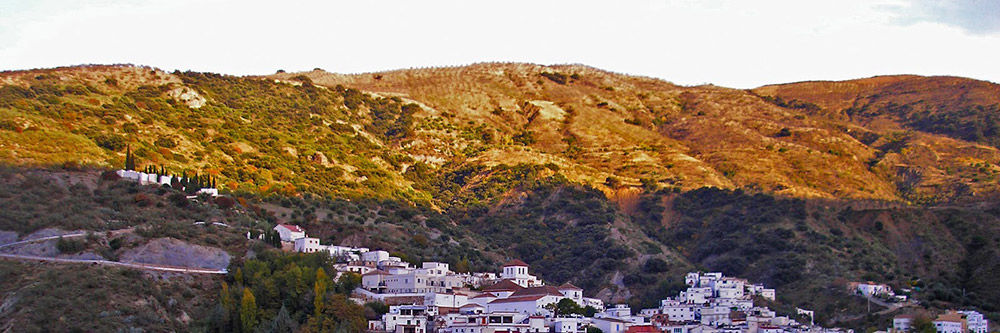
Reaching the bottom of the gorge the path crosses a bridge over the river Trevélez where it passes another ruined mill (1 hr 25 mins) then climbs steeply up the north side of the gorge. After passing a number of terraced fields you reach the road running round the bottom of Busquístar, Calle Laurel (1 hr 40 mins) and an information board with a map of the area.
Here turn left and head along this street to its the junction with Calle San Francisco. Here you have a choice. If planning to visit Busquístar, or refill your water bottle, turn right and climb up into the village centre where there are bars and a spring. If not, you should cut left and begin to descend, passing a sign for Ferreirola, 2.7 kms and another which lets you know that you're following the ancient Camino Real. The path descends steeply, crosses a bridge and passes by some ramshackle byres. Your path comes in to meet with a track (1 hr 50 mins).
Here head straight on, climbing slightly. At the point where the track loops hard round to the right you should carry straight on, again picking up the old footpath by a G.R. marker post. This is a beautiful section of the walk as the path cuts between stands of evergreen oaks and clumps of gorse and cistus before cutting past a dramatic, rocky outcrop.
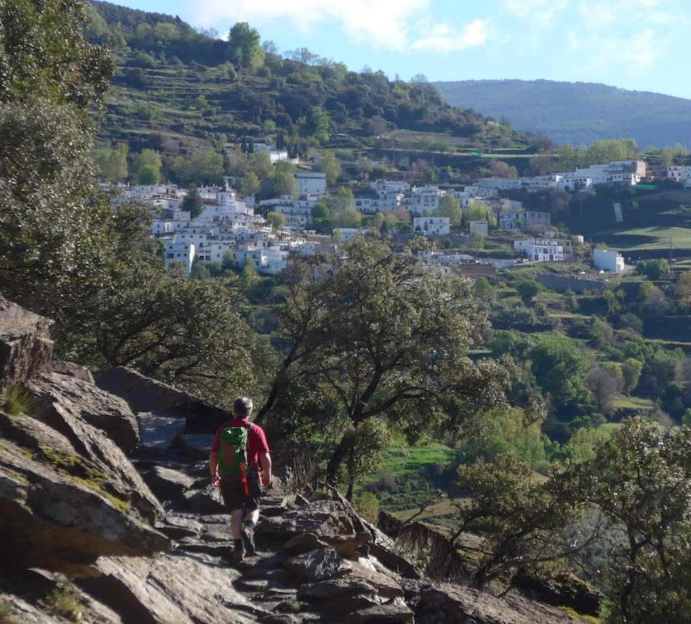
Soon you reach a fork in the path. Here maintain your same course, ignoring the turning left that would take you steeply down into the gorge. Ferreirola shortly comes into view as the path loops downwards. As the path runs on towards the village beyond it you will now be able to see Mecina and Mecina Fondales. Eventually the path drops down and meets with the path that you followed out of Ferreirola earlier in the day (2 hrs 15 mins). Here turn right and retrace your footsteps back to the village (2 hrs 30 mins).
Molino Altero – Trevelez

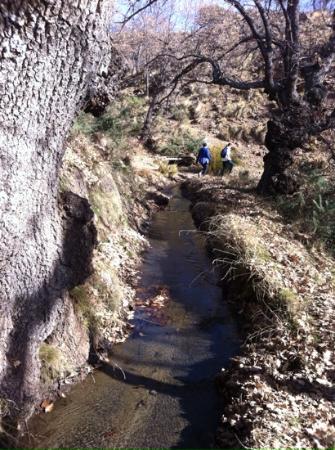
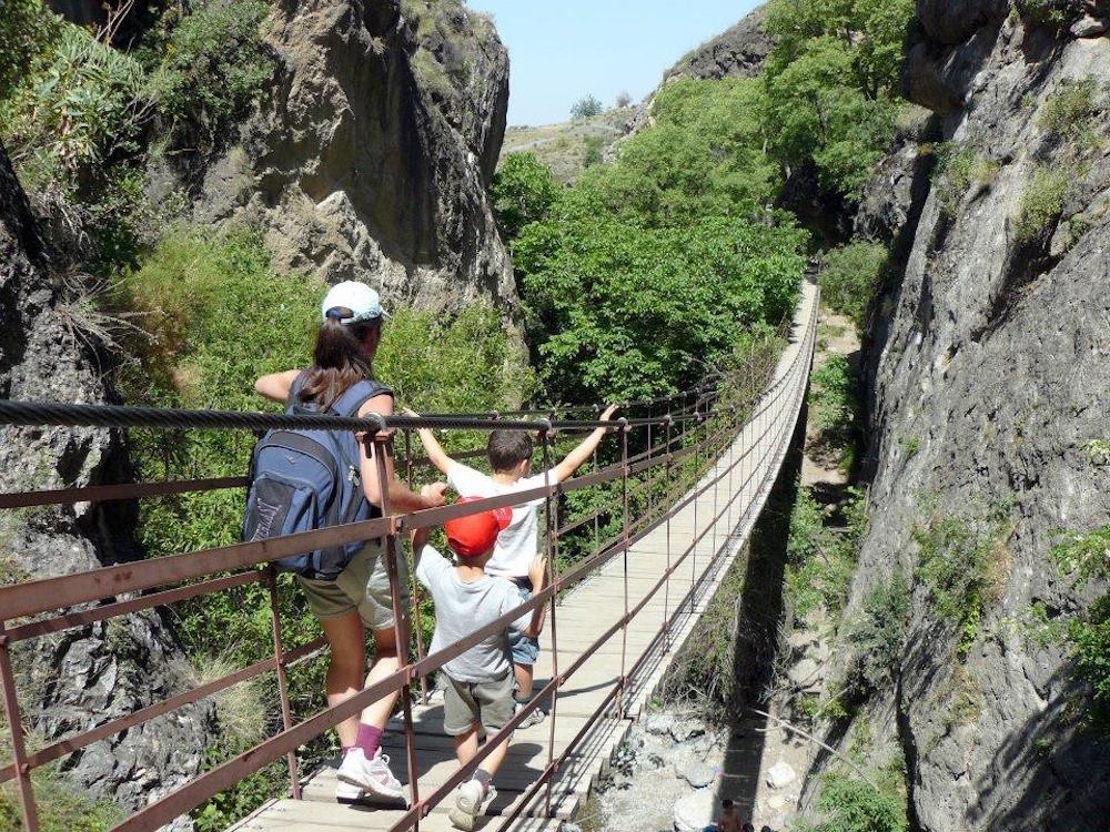
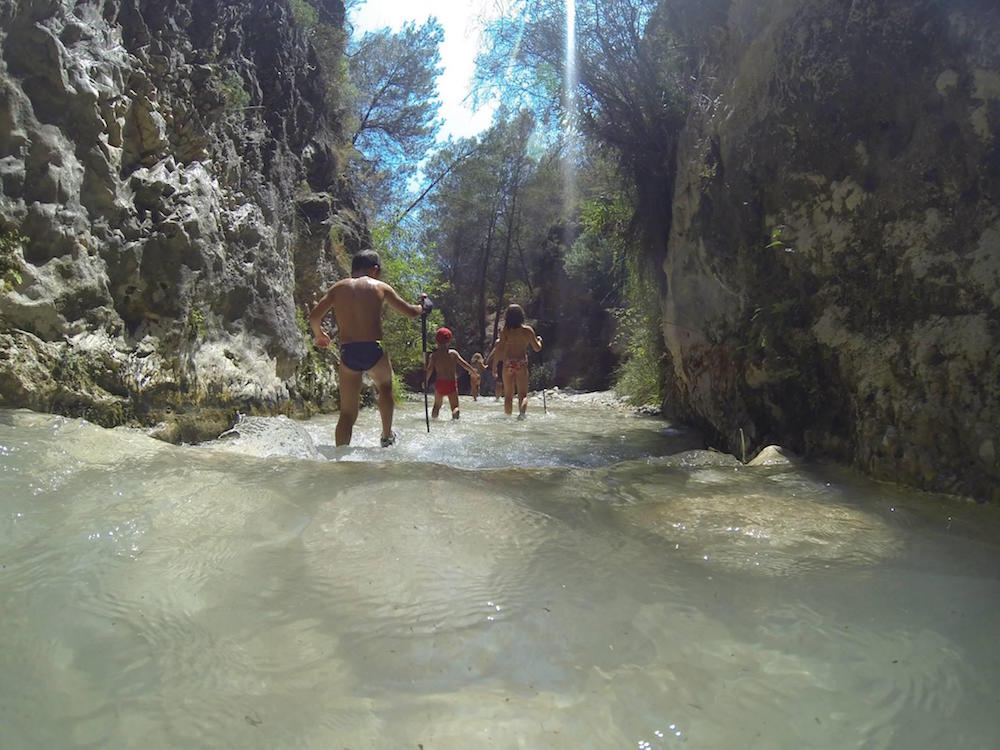
Monachil – Cahorros
This walk is about 7.8km and will take roughly 2 and a half hours.
With its wild flowers, fruit trees heavy with apricots, almonds, cherries, apples and pomegranates, a cascading river and lavender, thyme and rosemary, the lush Monachil valley is a beautiful area for walking. Kids will love the hanging bridges and the dramatic gorge, and this walk is particularly recommended when the flowers are out in spring and when the leaves turn gold in autumn.
The walk is suitable for most people, but bear in mind that there are sections where you need to scramble under overhanging rock along the side of the gorge. There are metal handles set into the rock to help you past. If you prefer, you can avoid much of the climbing by going back through the gorge rather than taking the circular route. It isn’t a difficult route to follow, but it is not consistently signposted, so pay attention to the directions given in the information sheet.
To get there head to the village of Monachil. After you enter the village, follow the signs for public parking for Los Cahorros. The signs lead you to a car park on the south side of the river at the far end of the village, near the sign marking the start of the walk.
Start the walk here following the river up through the gorge, then returning by a higher route, from which you get a good view of the whole valley.
1. Walk through the village along the river until you get to a bridge with lots of wooden signs, where the walk starts. Cross over to the south side of the bridge. Take the road uphill to the left (following the marked route Cahorros por sendero del río).
2. After about 100m take the path down to the left. Follow the path along the river.
3. After 900 m, turn left onto a track. Go around a hydropower station and take the steps back down onto the path.
4. After another 300 m, cross the hanging bridge and then turn right onto a path along the acequia (irrigation channel).
5. The path takes you across a second hanging bridge, then up some steps. Follow the steps round to the left, staying on the main path with the wooden railing. Once you have crossed a third hanging bridge, turn right and then cross a much longer bridge. A sign here warns that only up to four people can cross at once.
6. This is the most spectacular part of the walk, but the path through the gorge is quite awkward in some sections due to lack of head clearance. Make use of the metal handles set into the rock. Once you come out of the end of the gorge, turn left across the river.
7. The path winds uphill. After about 700m there are some wooden signposts. Keep on the main track towards Monachil and Purche.
8. After a further 800m you reach the top of the hill and there is another signpost marking Azuelas and Cno. Revoltilla Purche. Ignore these signs and bear left on the main track.
9. Keep on the main track, ignoring farm tracks turning off to the left. When you get to wooden signs for Purche Est. De Esqui and Azuelas Hazallana, turn left (again taking the unmarked route).
10. Again, keep on the main track, ignoring farm accesses and signed footpaths to the left. After less than 2km, you will see a car park and the main road ahead of you. Join the main road briefly and then return to the village, taking a side road past a restaurant. Go straight across the main road when you meet it again.
It you want to get closer to the river drive through the urbanisation and follow the road upwards to the right. Passing under the motorway you should see the river on your left. The concrete road dips back down towards the river and becomes a track. Keep following this track as far as you can.
Parking has become more problematic in recent years. Park anywhere you can, more often than not you’ll find parking on the road that leads down to the cement factory. Be careful to respect any no parking signs and entrances to houses. Cars are often towed in the summer months.